For astrodyamics modeling, visualization, and system integration
Spacecraft Propagation
Complete high fidelity orbit integration, force modeling, and ephemeris features
Orbit State Integrators
Runge Kutta 4(5), 7(8), 8(9), VOP, two body, Bulirsch Stoer, J2 Mean Elements, SGP4
Fixed or variable step size
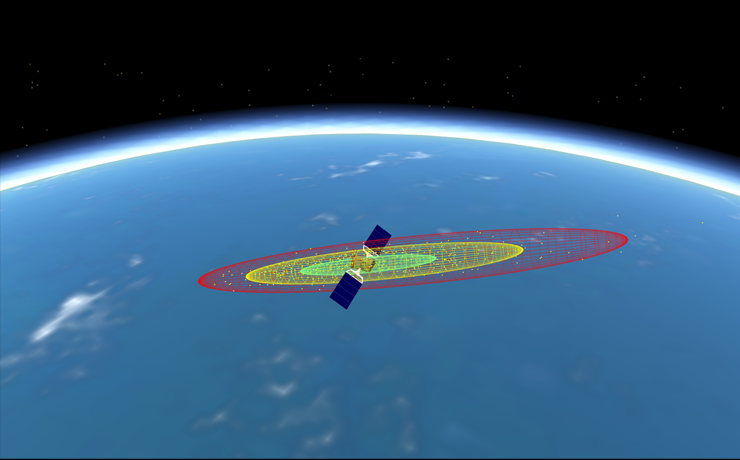
Constellation Flying
Formation, constellation, and debris catalog modeling supporting an unlimited number of space objects
Ephemeris Propagation
User-definable state vector and formatting in FreeFlyer ephemeris format
STK ephemeris, SP3 Precise Ephemeris and CCSDS OEM file formats
8th and 10th order Lagrange ephemeris interpolation
Force Modeling
Celestial body gravitational potential (point mass, zonals and tesserals, solid tides), atmospheric drag / lift, cannonball or flat plate solar radiation pressure
Orbit Reference Frames
International Celestial Reference Frame (ICRF), Mean of J2000 Earth Ecliptic, True of Date Earth Equator, True Equator Mean Equinox, Earth Fixed, CelestialObject fixed reference frames
Element Sets
Cartesian, Keplerian/nonsingular Keplerian, Spherical/Spherical Lat/Long, Equinoctial, Modified Equinoctial, Brouwer-Lyddane Mean/J2, Brouwer-Lyddane Mean of 1950 orbital element systems
Attitude Frames
LVLH, ICRF, Geodetic, UVW, VNB, and user-defined custom attitude reference frames
Attitude State Systems
Euler angles, Quaternion, Attitude matrix, Spinner attitude modeling
Attitude history file (AHF) support
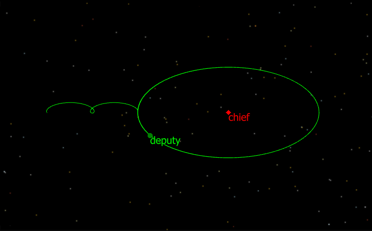
Relative Motion & Proximity Operations
Hill-Clohessy-Wiltshire (HCW) propagator
LVC (Cylindrical), RIC Cylindrical, and RIC Spherical attitude reference frames
Relative Motion Orbit Wizards for Proximity Operations (ProxOps) Curvilinear relative states
Generating Output
Immersive visualizations that make analysis and situational awareness second-nature
Viewpoints
2D and 3D visualization with customizable camera Viewpoints
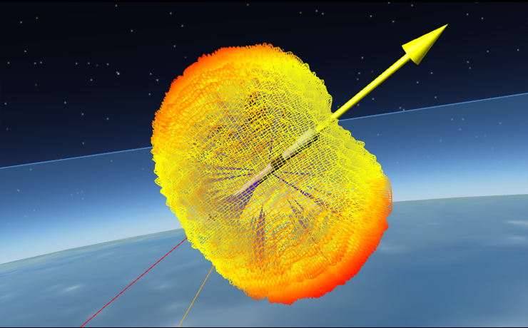
Sensor Viewpoints
Rotating-Pulsating Viewpoints
Reports
User-defined custom text or binary file reports
Console window reports
2000+ built-in parameters available for reporting and plotting
Unlimited user-defined parameters for reporting and plotting
Output Workspace
Unlimited output window tiling
Output layout control for controlling size and location of output windows
Pop output windows in/out of the FreeFlyer Workspace
Customized Visualizations
GraphicsOverlay and WindowOverlay for adding custom elements to visualizations
Globe layers to support coastlines, coastal offsets, political boundaries, and user-defined line layer element sets
FreeFlyer Scripting
Our script-driven approach gives you the full control you desire
Scripting Language
Object-oriented scripting language to control all aspects of a FreeFlyer Mission Plan (objects, methods, commands, conditional logic, data inputs/outputs, and custom computations)
Script Editor
Full-featured FreeForm scripting language editor with general programming convenience functionality such as finding all references, smart indenting, and script auto-complete
Logic Control
Logic to control actions based on any calculated property
For, If, While, Pause, Stop, Achieve, Target, Vary, Break, Switch, Continue commands
Math Engine
30+ math operators for implementing custom algorithms
Random number generator and matrix math
Conversion between all supported time systems and time formats
Debugging
Integrated debugger with breakpoints, inspector, call stack, mouse-over, and ability to step line-by-line
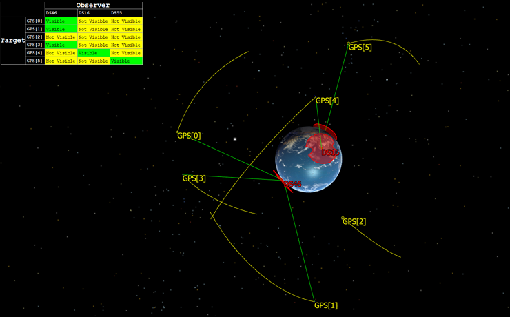
Coverage and Contact
Precisely calculate the start and stop times of a specified event
Ground Stations
400+ pre-defined GroundStation geodetic files and masking profiles
Define custom GroundStation objects on any celestial body
Determine visibility from a GroundStation
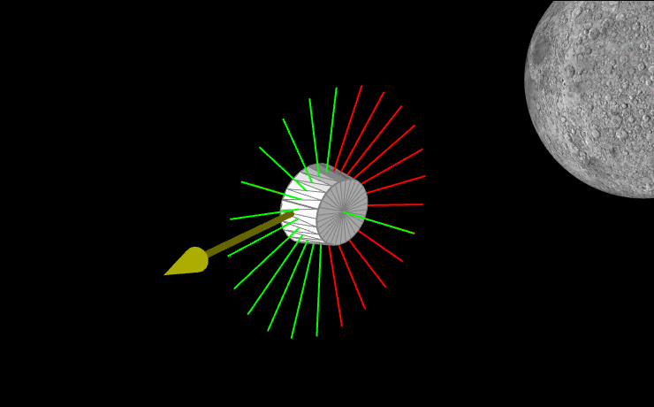
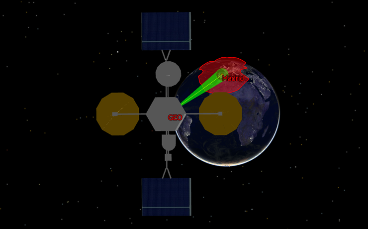
Sensors
Complex conic, rectangular, and user-defined sensor shapes
Sensor obscuration masking
Dynamic Sensor scanning
Configure output windows in a view looking down the boresight of a Sensor
Interval Methods
Calculate the start/stop times and duration of a specified event down to nano-second level accuracy
Calculate entry/exit from contact between spacecraft and other assets, passes through umbral and penumbral shadow, intersection times between a spacecraft and a ProximityZone, and more.
Visibility Calculators
Determine whether an observer can see a target, based on user-specified configuration for occulting bodies, occulting terrain, celestial object shape models, and refraction
Visibility period calculations between any objects (Spacecraft-to-Spacecraft, Spacecraft-to-GroundStation, Spacecraft-to-custom Region, etc.)
Vectors to and from any object
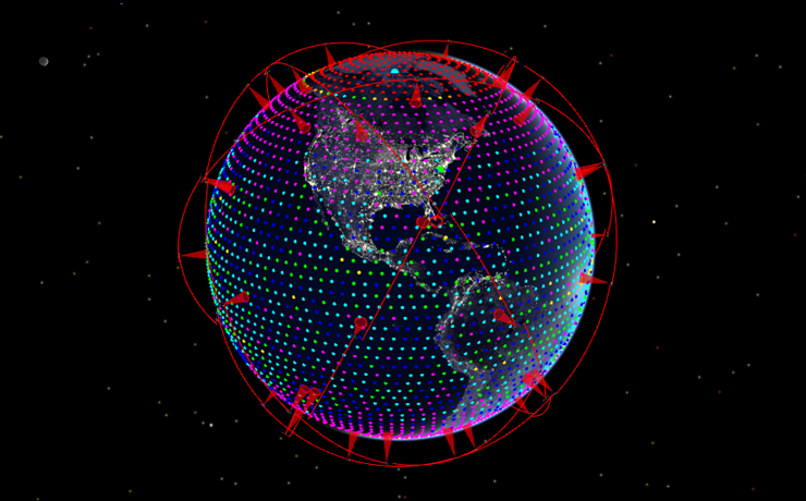
Point Groups
Create a collection of points located on or near the central body’s surface
Specify the number of points and coverage area
Compute contact with each point and detailed sensor contact information
Regions
Closed contour area on a Celestial Object's surface, defined by a series of planetodetic latitude and longitude points (also called vertices)
Used to identify when a Spacecraft is over an area on the surface of a CelestialObject, or when a Spacecraft’s Sensor “sees” a region
Proximity Zones
Attached to a Spacecraft for use in proximity analysis and visualization
Used to perform conjunction assessment, by calculating the intersection times with other Spacecraft or ProximityZones, or determine a Sensor’s field of view
RF Link Analysis
Used for radio frequency (RF) analysis between GroundStation objects or other Spacecraft objects
RFLink object can be used to determine a transmitter or receiver's effective gain, effective isotropically radiated power (EIRP), power, noise, signal to noise ratio (SNR), link margin, and free space path loss (FSPL).
Ground Vehicles
Model non-orbital vehicles within FreeFlyer
Simple Motion or Waypoint propagation
Support for ICRF, VLT, and ENU attitude reference frames as well as Euler Angles, quaternion, and attitude matrix attitude modeling
Maneuvering and Targeting
Comprehensive maneuver planning, modeling, calibration, reconstruction, and estimation capabilities
Finite Burns
Used to model the effect of a finite-thrust maneuver on a Spacecraft orbit
Specify the number of seconds that active Thrusters are supplying acceleration
Supported in ICRF, VNB, LVLH, Spacecraft Attitude, Geodetic, UVW, and RIC attitude reference frames
Hardware
Support for standard chemical and low-thrust propulsion systems
Three types of Tank models are available: Spherical Tank, Chemical Non-Spherical, and Electrical
Support Chemical and Electrical thrusters allowing for detailed user-input on location, pointing, and performance information
Vales allow the user to model Thrusters connected to multiple tanks: bi-propellant, redundant supplies, or both
Impulsive Burns
Used to provide an instantaneous velocity change to a Spacecraft
Supported in ICRF, VNB, LVLH, Spacecraft Body Fixed, Geodetic, UVW, and RIC attitude reference frames
Outgassing Events
Used to model the effect of accelerations due to a leaking thruster on a Spacecraft
Supported in ICRF, VNB, LVLH, Spacecraft Body Fixed, Geodetic, UVW, and RIC attitude reference frames
Targeting
Maneuver targeting with differential correction algorithms
Dynamic configuration of the Targeter for resetting initial guesses and use within conditional For/If/While loops
Optimization
Multivariable optimization of user-defined objective functions
Generic Capabilities
Solve a variety of problems related to trajectory design, maneuver planning, and more
Definition of any number of state variables and constraints
Ability to minimize or maximize any objective function
Support for finding a feasible solution to solve constraints without optimizing an objective function
Optimal Control
Support for generic optimal control through the use of segmented trajectory arcs and specific control models: ballistic, simple thruster, and ideal solar sail
Add bounds and constraints to the optimization problem to reflect real world limits
Configure and link multiple trajectory phases
3rd-order Legendre-Gauss-Lobatto (LGL) collocation transcription
Optimization Engines
Built in support for Ipopt (Interior Point Optimizer) and NLopt (NonLinear Optimizer) engines
Support for SNOPT through user-provided shared library file
Global optimization support through NLOpt
Interplanetary Analysis
Take your analysis beyond Earth
Object Centeral Bodies
Support for all planets in the solar system, the Moon, and custom celestial objects
Model multiple gravitational potential fields in the propagation of a Spacecraft
Field types ranging from Point Mass to Zonal and Tesseral Potential with Solid Tides for all bodies
Interplanetary Coverage
User-defined GroundStation location and masking profiles on any CelestialObject
User-defined Regions on any CelestialObject
CelestialObject interference (all planets and star catalog)
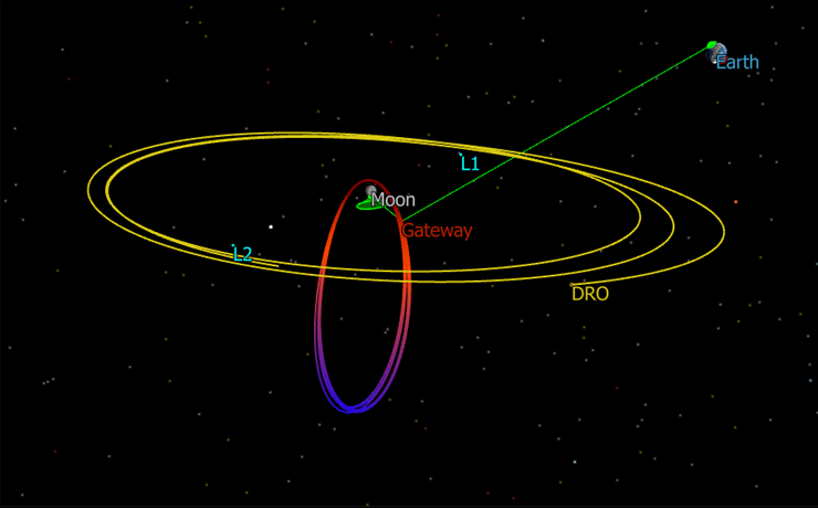
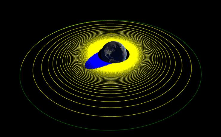
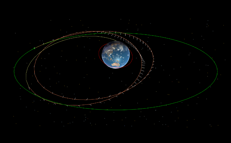
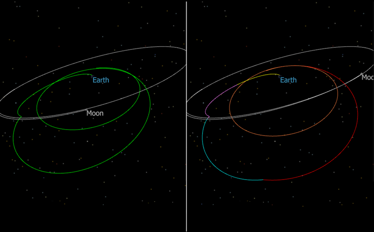
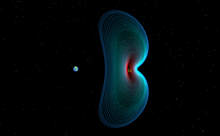
Rotating Libration Points
FreeFlyer allows you to work with rotating libration points (L1-L5) in any system
Rotating libration point (RLP) frame can be defined using any two built-in or user-defined CelestialObjects or CelestialSystems (representing system barycenters)
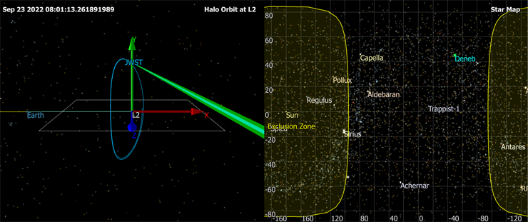
Stars
Global Stars object pre-populated with a standard catalog of stars
Custom StarField object to allow users to define your own set of stars
Ability to be used with coverage and contact output methods
Interplanetary Mission Design
Built-in SolarSystem object which allows users to modify how FreeFlyer models the solar system environment
B-Plane targeting
SPICE Ephemeris read/write support
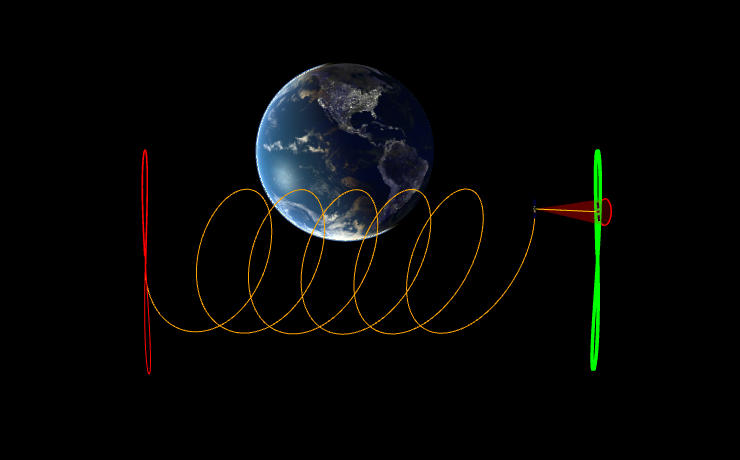
Rotating-pulsating coordinate system calculation and visualization
Interfacing with External Resources
Interface FreeFlyer with other tools and resources
Files
Generic ASCII and Binary FileInterface for user-defined ephemeris/state and other I/O applications
JSONInterface object allows users to easily import and export JSON=formatted data
Parse arbitrary string data file formats through FreeFlyer script
Extending FreeFlyer
Runtime Application Program Interface (RTAPI) for embedding FreeFlyer into an external C/C++, Java, Matlab, or Python application
FreeFlyer Extensions Software Development Kit (SDK) for custom force modeling, object definition, and 3rd party code integration
Matlab
Native MatlabInterface object available to use at the script level to establish bi-direction communication between FreeFlyer and MATLAB
Utilize FreeFlyer’s precision spacecraft modeling interactively with custom mathematical models in MATLAB
Databasess
Native connectivity to Database Management Systems (DBMS), providing the ability to access the storage and processing power associated with relational databases
User-supplied SQL statements specify the DBMS actions to be performed
Sockets
TCP/IP socket interface allowing for data exchange between programs running on computers connected by a LAN/WAN
Set up a Socket to pull data directly from programs like Celestrak
Custom User-Interfaces
Customizable graphic user interface (GUI)
Create a custom GUI for data input, data display. etc.
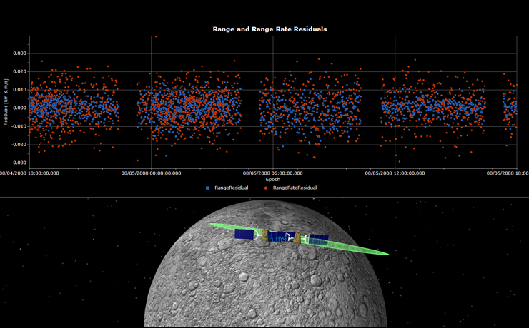
Orbit Determination
Robust, easy-to-use, and convenient system for computing a weighted fit between a user’s measurements and the propagated a priori state of a Spacecraft
Performing State Estimation
Support for Extended Kalman Filter, Unscented Kalman Filter, Square Root Information Filter, and Batch Least Squares
Customizable Batch/Kalman combinations implemented via script
Spacecraft position, velocity, acceleration, Cd, Cr estimation
Maneuver and outgassing estimation
GroundStation location, antenna bias estimation
Transponder delay estimation
Observations and Measurements
Fully customizable user-specified tracking data
Ground-based range/range rate/azimuth/elevation tracking data
TDRS tracking two-way range/two-way Doppler tracking data
Point solution and GNSS pseudorange tracking data
Spacecraft-to-Spacecraft range/range-rate/azimuth/elevation tracking data
BRTS tracking data
DSN 60-byte and three-way Doppler tracking data
Coverage Propagation
Propagate covariance using an OD process or through general propagation
Built-in CovarianceUtilities object providing several static utility methods for working with a covariance matrix
Tracking Data
Simulate tracking data for any observation type
Generate tracking data files in standardized formats
TrackingDataEditor with sigma threshold editing that can view multiple measurement types simultaneously
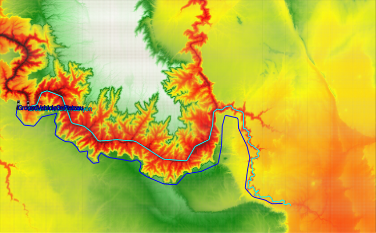
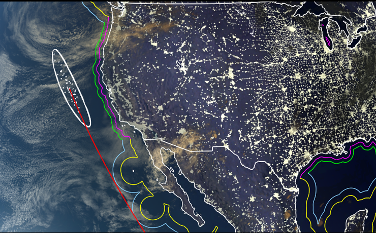
Terrain Modeling
Ingest terrain files for analysis, reporting, and visualization capabilities to aid in ground-based analyses with critical space or air assets
Analysis
Determine line-of-sight visibility with occulting terrain between two objects orbiting in space, stationary anywhere, or moving on the ground
Query elevation at specified latitude/longitude
Integration for modeling GroundVehicle state during propagation
Visualize with either PointGroups or GraphicsOverlays
Terrain Index Generator
Built-in command line utility to pre-process Terrain data files and create terrain index files
Allows for user-defined index resolutions to accelerate processing terrain intersection queries
File Ingestion
No server needed
Import any Geospatial Data Abstraction Library (GDAL) format including GTOPO30, SRTM, NED, and more.
Other Features
Robust, easy-to-use, and convenient system for computing a weighted fit between a user’s measurements and the propagated a priori state of a Spacecraft
Additional Resources
World-class technical support team available for assistance
Extensive Help File with all property definitions, syntax, guides, and examples
FreeFlyer Forum
Learning Materials
200+ Sample Mission Plans included with install
YouTube Training Materials
FreeFlyer University Guide
Features
Customizable Home Screen
Auto-save Mission Plan feature
Available in Windows and Linux